Montana Hunt Access Maps Explained
Trying to figure out where you can legally step foot while hunting in Montana can feel like navigating a maze blindfolded. One minute you're on prime elk ground, the next you're staring at a "No Trespassing" sign, wondering if you just ruined your season – or worse, ended up in legal trouble. This isn't just a minor inconvenience; it's a genuine source of anxiety for many hunters, especially those new to Big Sky Country. Understanding Montana hunt access maps is absolutely vital for any hunter, whether you're a seasoned local or a wide-eyed nonresident, and this guide will peel back the layers of those complex maps to help you hunt confidently and ethically.
The Indispensable Role of Hunt Access Maps in Montana
Let's be honest, the thought of hitting a new hunting spot, or even a familiar one, without knowing exactly where the boundaries lie is enough to make anyone sweat. Montana, with its vast landscapes and often complex land ownership patterns, demands a thorough understanding of where you can and cannot go. This isn't just about avoiding trouble; it's about unlocking opportunities and making the most of your precious hunting time.
The Frustration of Mixed Ownership and Checkerboard Land
Montana's land ownership can be a real head-scratcher. You've got massive tracts of public land, yes, but often these are interspersed with private holdings in a complicated "checkerboard" pattern, particularly prevalent in areas with historical railroad grants or where timber companies own large chunks. It's truly baffling to see a clear-cut logging road that looks like public access suddenly bordered by private property signs, or a pristine river bottom winding through a mix of public and private ownership. This mixed ownership is a primary source of frustration for hunters, leading to wasted time, missed opportunities, and the constant fear of inadvertently trespassing.
Imagine you've driven for hours, hiked miles into what looks like prime elk country, only to pull out your traditional paper map and realize it's nearly impossible to tell if that dark timber stand a half-mile away is public or private. You're left guessing, perhaps choosing to avoid what could be excellent hunting rather than risk stepping over an invisible line. This uncertainty can drain the joy out of a hunt and leave you feeling utterly defeated before you even draw your bow or shoulder your rifle. It's a common struggle, and it's why modern mapping tools have become non-negotiable for serious hunters here.
Beyond Boundaries: Unveiling Opportunities and Avoiding Pitfalls
Hunt access maps are far more than just "don't trespass" guides. They are your key to unlocking the full potential of Montana's diverse hunting landscape. By understanding the intricate layers of land ownership, you can identify hidden pockets of public land, locate forgotten easements, and pinpoint access points that might not be obvious from a main road. These maps allow you to strategically plan your approach, identifying bottlenecks where game might move between public and private land, or finding quiet corners away from heavier hunter pressure.
Think of it this way: a good map doesn't just show you where the fences are; it shows you where the gates aren't. It reveals the veins of public access that run through vast private tracts, providing entry to areas many others overlook. For instance, you might discover a small section of state land that borders a large private ranch, offering a strategic vantage point to glass for elk moving off the private property. Or perhaps an old logging road that used to be a dead end is now identified as a legal access route to a new public hunting area. Our comprehensive Montana Public Land Hunting Guide elaborates on these strategies, but it all starts with accurate mapping. These tools are the foundation for any successful and stress-free hunt in Big Sky Country.
Decoding Montana's Diverse Land Designations
Montana is a patchwork of different land types, each with its own rules, opportunities, and access considerations. Knowing the difference between National Forest and State Trust Land, or understanding the nuances of a Block Management Area, is critical for effective planning and execution of your hunt. Without this knowledge, you're essentially walking into a complex game without knowing the rules.
Navigating Public Land: National Forests, BLM, and State Trust Lands
Montana boasts millions of acres of public land, a true blessing for hunters. However, not all public land is created equal, and each type comes with its own characteristics and typical hunting scenarios.
- National Forests: These are often the rugged, mountainous havens many visualize when they think of Montana hunting. Administered by the U.S. Forest Service, these lands offer vast stretches of timber, high-alpine basins, and deep wilderness. They are fantastic for elk, mule deer, and bear hunting, often requiring significant physical effort to access prime areas. Think the Custer Gallatin or Beaverhead-Deerlodge National Forests. Generally, these lands are open to hunting unless specifically closed for safety or wildlife management reasons. You can pack in, set up camp, and often find solitude if you're willing to put in the miles. Our Montana National Forest Hunting Guide provides in-depth strategies for these wild places.
- Bureau of Land Management (BLM) Lands: BLM lands in Montana are incredibly diverse, ranging from forested mountains in the west to vast, rolling grasslands and badlands in the east. These lands are generally open for public access and hunting. You'll often find them interspersed with private land, making accurate mapping essential. BLM land in eastern Montana, for instance, is prime for antelope and often offers good mule deer hunting in the coulees and breaks. Access roads can vary from well-maintained gravel to barely-there two-tracks, so having a good map to navigate these routes is paramount. For more on these areas, check out our guide on Montana BLM Land Hunting.
- State Trust Lands: Managed by the Montana Department of Natural Resources and Conservation (DNRC), these lands were set aside to generate revenue for public education and institutions. While they are public, access requires a valid "State Land Use License" in addition to your regular hunting license. This license is inexpensive and easy to acquire but is absolutely necessary. State Trust Lands can be found throughout the state and are often smaller, isolated parcels. They can hold surprising numbers of game, especially if they border private agricultural land or offer unique habitat features like isolated timber pockets or water sources. Always verify access points, as some parcels might be landlocked by private property.
Understanding these distinctions helps you predict the terrain, identify potential game, and know which permits you need before you even leave home. It transforms a generic "public land" search into a targeted, informed strategy.
Understanding Private Land and Critical Access Programs
Private land in Montana makes up a significant portion of the state, and much of it holds excellent hunting opportunities. However, navigating private land is where things get tricky, as direct access usually requires explicit permission from the landowner. The days of simply knocking on a farmhouse door and getting permission are, unfortunately, becoming less common, especially in high-demand areas. This is where programs designed to foster public access on private land become absolutely invaluable.
- Block Management Areas (BMAs): This is Montana Fish, Wildlife & Parks' (FWP) shining star program, connecting hunters with private landowners who allow public hunting access on their property. BMAs vary widely in size, game species available, and specific access rules. Some are "Type 1" areas where you can simply sign in at a kiosk, while "Type 2" areas often require hunters to check in with the landowner directly, sometimes even making reservations. These areas are predominantly found in central and eastern Montana, offering fantastic hunting for deer, antelope, and sometimes even elk. Without the Block Management program, vast tracts of prime hunting land would be completely inaccessible to the average public land hunter. Always consult the FWP Block Management Guide for the most current information, as rules and available areas change annually. It's a crucial piece of the puzzle, and our Montana Block Management Areas Explained article delves much deeper into this vital program.
- Landowner Permission and Hunting Leases: Beyond BMAs, direct landowner permission is the traditional route to private land hunting. This involves respectful communication, building relationships, and often a lot of persistence. Some landowners will grant free access, while others may offer exclusive hunting rights through a paid lease. While leases can be expensive, they guarantee access to potentially excellent, low-pressure hunting ground. Digital mapping tools can help identify specific landowners, making the process of requesting permission a bit easier, as you'll know exactly who to contact. It's important to remember that all forms of private land access are a privilege, not a right, and should be treated with the utmost respect.
Here's a quick overview of Montana's primary land types:
| Land Type | Administering Authority | Typical Terrain | Access Requirements | Primary Considerations |
|---|---|---|---|---|
| National Forest | U.S. Forest Service | Mountains, Timber, High Country | General public access | Remote, physical effort, wilderness rules |
| BLM Land | Bureau of Land Management | Plains, Foothills, Badlands, Rivers | General public access | Mixed ownership, varied access roads, Eastern Montana focus |
| State Trust Land | MT DNRC | Diverse, often isolated parcels | State Land Use License required (in addition to hunting license) | Verify access, often bordered by private, scattered parcels |
| Private Land (BMA) | Private Landowners (via FWP) | Diverse | Varies by BMA (sign-in, reservation, direct contact) | Rules specific to each BMA, seasonal changes, key access |
| Private Land (Direct) | Private Landowners | Diverse | Direct landowner permission required | Respectful communication, property boundaries, leases |
This table underscores why understanding the different designations is so important. Each type presents a different set of opportunities and challenges for the hunter.
Essential Digital Tools for Modern Montana Hunters
The days of relying solely on paper maps and vague directions are long gone for most serious Montana hunters. While paper maps still have their place as a backup, digital hunt access maps have revolutionized how we scout, plan, and execute our hunts. These tools provide real-time, detailed information that was unimaginable a few decades ago.
onX Hunt: The Gold Standard for Real-Time Land Info
When it comes to digital hunting maps, onX Hunt has truly become the industry leader and, for many, an absolutely essential tool for hunting in Montana. If you're serious about navigating Montana's complex land ownership, having onX Hunt on your phone or GPS device is almost a non-negotiable.
What makes onX Hunt so powerful? First and foremost, its land ownership layers are incredibly accurate and regularly updated. You can instantly see public land (National Forest, BLM, State Trust), private land, and crucially, the names of private landowners. This feature alone is a game-changer for avoiding trespass and for identifying who to contact if you're seeking permission on private ground. The color-coded maps make it incredibly easy to distinguish between different land types at a glance.
Beyond ownership, onX Hunt offers a suite of features that significantly enhance your planning and in-the-field experience:
- Offline Maps: This is critical in Montana's vast backcountry where cell service is often nonexistent. You can download maps for your hunting unit before you leave home, ensuring you always have detailed information at your fingertips, even miles from the nearest signal.
- GPS Tracking and Waypoints: The app tracks your movements, showing you exactly where you've been. You can drop custom waypoints for anything – a game trail, a water source, a rub line, a gate, or even where you parked your truck. This is invaluable for navigating dense timber or finding your way back in the dark.
- Topographical and Satellite Imagery: Toggle between topo maps (showing elevation changes, drainages, and ridges) and crystal-clear satellite imagery. This allows you to identify potential bedding areas, travel corridors, and glassing points long before you ever step foot in the unit.
- Hunt Layers: onX Hunt includes specific layers for game units, wilderness areas, roadless areas, and even specific walk-in programs. While it doesn't always have current Block Management data directly integrated with landowner parcels, it's still a powerful tool for general access.
- Wind & Weather Overlays: Recent updates have integrated real-time wind direction and speed, which is vital for planning stalks and understanding how scent will carry.
Using onX Hunt transforms the daunting task of deciphering Montana's land into an intuitive process. It lets you plan routes, identify boundaries, and even find those small, overlooked parcels of public land that others miss. For an even deeper dive into maximizing this tool, check out our guide on How to Use onX for Montana Hunting.
GoHunt and Other Strategic Planning Platforms
While onX Hunt excels in field navigation and real-time boundary identification, other platforms offer complementary strengths, particularly in the realm of strategic planning and research.
- GoHunt: This platform is a fantastic resource, especially for nonresident hunters looking to understand draw odds, analyze units, and plan multi-year strategies. GoHunt's strength lies in its comprehensive data for Western state draws, including Montana. Their "Insider" membership provides detailed unit profiles, harvest statistics, public land percentages, and crucial information that can help you decide where to apply for limited entry permits. While GoHunt also offers mapping capabilities, often powered by an integrated mapping solution, many hunters use it in conjunction with onX Hunt. GoHunt for the strategic "where to apply" and "what are my odds" questions, and onX Hunt for the in-the-field navigation once a tag is secured. Their maps allow for robust E-scouting, helping you identify potential areas based on public land access and historical game data.
- Garmin Handheld GPS Devices: For those who prefer a dedicated GPS unit or want a bomb-proof backup to their phone, Garmin devices with preloaded mapping software (like Garmin's HuntView Plus) are still incredibly reliable. These devices are rugged, have excellent battery life, and often come with detailed topographic and land ownership data, similar to onX, but in a dedicated hardware format. Many hunters will run both a phone app and a Garmin for redundancy.
- Montana FWP Online Tools: Montana Fish, Wildlife & Parks (FWP) also provides excellent online resources, including their Hunt Planner map and various downloadable PDF maps for Block Management Areas. While not as dynamic or feature-rich as commercial apps, these official resources are invaluable for cross-referencing information and ensuring you have the latest state-specific data. Always consult the FWP website for official regulations and BMA specifics, as these are the ultimate authority.
By combining the powerful field navigation of onX Hunt with the strategic research capabilities of platforms like GoHunt and official FWP resources, you create a robust system for tackling Montana's complex hunting landscape. It means less time worrying about where you are and more time focusing on the hunt itself. For more on strategic planning, our guide on How to E-Scout Montana Districts offers additional insights.
Mastering the Art of Map Interpretation
Having the best digital maps in your hand is only half the battle. The other half is knowing how to effectively read and interpret all the information they present. A map is a language, and learning its vocabulary and grammar will give you a significant advantage in the field. This goes beyond just seeing colors; it's about understanding what those colors, lines, and symbols truly represent in the real world.
Understanding Color Codes, Overlays, and Topographical Data
Digital hunt access maps use a variety of visual cues to convey a wealth of information. Learning to quickly decipher these elements is key to efficient scouting and navigation.
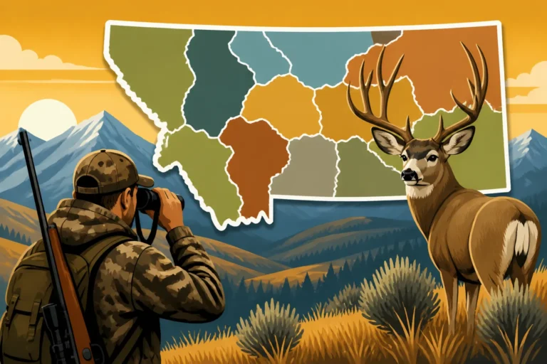
- Color Codes for Land Ownership: This is perhaps the most fundamental aspect. Different shades of green for National Forest, yellow for BLM, blue for State Trust Land, and white/gray for private land are standard. Some apps might even differentiate private lands by ownership (e.g., individual, corporate, tribal). The ability to quickly identify these colors helps you immediately understand the legal status of the ground you're looking at. For example, spotting a small patch of "blue" state land surrounded by "white" private can indicate a potential, low-pressure hunting opportunity if you have the correct State Land Use License and a legal access point. Our guide on Public vs Private Land Hunting in Montana covers these distinctions in more detail.
- Overlays for Specific Information: Modern maps often have various "layers" you can toggle on or off. These might include:
- Hunt Unit Boundaries: Essential for knowing which regulations apply to your specific tag.
- Roadless Areas/Wilderness Boundaries: Indicates areas where motorized travel is restricted or prohibited, often signifying deeper backcountry hunting.
- Wildlife Habitat Layers: Some advanced maps or species-specific modules might highlight known winter ranges, migration corridors, or bedding areas.
- Burn Areas: Recent wildfires can dramatically alter habitat and provide new growth, often attracting elk and deer. Maps with updated burn perimeters are invaluable.
- Water Sources: Identifying creeks, springs, stock ponds, and rivers can be crucial, especially in arid regions or during early archery seasons when game is tied to water.
- Topographical Data: This is where the magic of understanding terrain comes in.
- Contour Lines: These lines depict elevation changes. Closely spaced lines mean steep terrain; widely spaced lines indicate gentler slopes. Learning to "read" topo lines helps you visualize mountains, valleys, saddles, ridges, and drainages.
- Shaded Relief: Often an overlay, shaded relief adds a three-dimensional effect to the map, making hills, canyons, and peaks pop out, even without distinct contour lines. This is incredibly helpful for identifying potential bedding areas (often on north-facing slopes in dark timber) or travel routes (ridges, saddles).
- Slope Angle Shading: Some maps offer a layer that highlights areas based on their steepness, allowing you to identify terrain that might be too dangerous or physically demanding to traverse, or conversely, areas that offer natural barriers to other hunters.
By combining these visual elements, you can paint a comprehensive picture of the hunting ground, predict game movement, and plan your routes with an intimate understanding of the landscape.
Identifying Access Points, Easements, and Landlocked Public Parcels
One of the most powerful applications of detailed hunt access maps is their ability to reveal pathways and legal entry points that are not always obvious from the ground. This takes map interpretation to the next level, transforming a static image into a dynamic strategy tool.
- Legal Roads and Trails: Maps clearly delineate public roads, forest service roads, and designated trails. It's crucial to understand the difference between legal public access roads and private two-tracks. Many public roads might be gated during certain seasons or beyond a certain point, and maps often indicate these seasonal closures. Always cross-reference with local forest service or FWP travel management plans, as vehicle access can be very specific.
- Easements: An easement is a legal right to use another's land for a specific purpose, such as public access to a landlocked piece of public property. Maps, particularly onX Hunt, will often highlight these easements, which can be critical for reaching remote hunting areas. For example, a legal easement might cut directly through a section of private ranch land, providing a public "corridor" to a pristine block of National Forest that would otherwise be inaccessible. These are golden opportunities, but you must stay strictly within the easement boundaries.
- Walk-In Access Programs: In addition to Block Management, Montana has other walk-in access programs, often marked on FWP maps or through specific map layers. These allow foot traffic onto private lands, sometimes for specific species or during certain periods. Always check the rules for each designated area.
- Landlocked Public Parcels: This is where careful map reading truly pays off. Montana has numerous small, isolated sections of public land (especially BLM or State Trust Land) that are completely surrounded by private property. Without legal access, these parcels are effectively private. However, digital maps allow you to identify these "islands" of public land. Your task then becomes to research if there's any legal way to reach them – perhaps a little-known easement, a river bottom that qualifies as public access, or through gaining specific landowner permission. Successfully accessing a landlocked public parcel can put you on game that rarely sees human pressure. Our guide on How to Access Landlocked Public Land in Montana provides detailed strategies for this advanced mapping technique.
By meticulously studying your maps for these features, you move beyond simply avoiding trespass and into actively discovering new, underutilized hunting grounds. It empowers you to maximize your hunting opportunities and truly explore Big Sky Country.
Integrating Map Intelligence with Real-World Hunting Strategy
While digital maps provide an incredible amount of information, they are just one piece of the puzzle. The most successful Montana hunters know that map intelligence must be fused with boots-on-the-ground reconnaissance and a keen awareness of dynamic environmental factors. Relying solely on a screen without validating that information in the field is a recipe for frustration.
Ground Truthing and Scouting: The Indispensable Field Check
No matter how advanced your mapping software is, it's never 100% current or complete. Boundaries change, fences are built, roads wash out, and landowners can revoke permission. This is why ground truthing – verifying map information with physical observation – is absolutely indispensable.
Think of it this way: you've spent hours E-scouting, marking potential bedding areas and water sources on your onX Hunt app. You've identified a promising ridgeline that appears to be public land, bordering a vast private timber tract. Now, before opening day, you need to physically go to that location.
- Verify Access Points: Is that forest service road still open, or has it been gated? Is the "walk-in access" point clearly marked, or has vegetation overgrown it? Are there new "No Trespassing" signs that weren't there last year?
- Confirm Boundaries: While onX is excellent, there can be discrepancies. Fences might not always align perfectly with the digital line, or a new fence might have been erected. It's crucial to know exactly where the physical boundary is.
- Assess Terrain: What looks like an easy ridge walk on a topo map might be choked with deadfall or incredibly steep. Satellite imagery helps, but nothing beats seeing the ground with your own eyes. You might discover a hidden bench or a thick pocket of timber that wasn't apparent on the map but is perfect for a mature bull.
- Look for Fresh Sign: Is there fresh elk scat, rubs, or tracks where you expected them to be? Have recent logging operations changed the habitat? Is the water source you marked still flowing, or has it dried up?
Ground truthing allows you to adapt your plans based on current conditions, avoiding unpleasant surprises on opening morning. It transforms theoretical map knowledge into practical, actionable intelligence, giving you confidence when you finally embark on your hunt. Our How to Find Public Land in a Montana District guide emphasizes these critical real-world steps.
Adapting to Seasonal Changes and Specific Regulations
Montana's landscape and hunting conditions are constantly in flux, influenced by seasons, weather, and ever-evolving regulations. A successful hunter doesn't just know where to go; they understand when to go and what rules apply.
- Seasonal Impact on Access: Early archery season might offer open roads that are snowed in by late rifle season. Winter closures for wildlife management or spring road bans due to muddy conditions can change how you access an area. A creek that's a trickle in August might be a raging torrent in October, blocking a planned route. Always consider the time of year and its potential effects on travel and terrain.
- Weather and Game Movement: Heavy snow can push elk and deer down from high country to lower wintering grounds, altering their distribution dramatically. A sudden cold snap might change their feeding patterns. Maps can show you these traditional wintering ranges, allowing you to anticipate movements. Our guide on Montana Hunting Seasons Explained can help you align your map scouting with the best times to hunt.
- Specific Regulations and Hunt Codes: Every hunting district in Montana has specific regulations that dictate what species can be hunted, with what weapon, and during which dates. Maps show hunt unit boundaries, but it's your responsibility to consult the official FWP regulations for that specific unit. For example, a general elk tag might be valid in one district, while an adjacent one requires a limited entry permit. Some districts have antler point restrictions or "either-sex" vs. "antlerless only" rules. Using a map to identify your target district, then immediately cross-referencing with the FWP regulations, is paramount.
- Dynamic Closures and Advisories: Fire season can bring fire-related closures to National Forests or BLM lands. Wildlife management zones might have temporary restrictions. These dynamic situations are rarely reflected in real-time on commercial maps. Always check the FWP website, Forest Service alerts, or local county sheriff's office for the most up-to-date information before heading out.
Combining detailed map knowledge with an understanding of these dynamic factors empowers you to make informed decisions, ensuring a safe, legal, and ultimately more successful hunting experience in Montana. Keeping abreast of changes, such as those outlined in our Montana 2026 Hunting Regulation Changes article, is part of being a responsible hunter.
Avoiding Common Pitfalls and Hunting Ethically
Hunting in Montana is a privilege that comes with significant responsibilities. The vastness and beauty of the state are intertwined with complex land management and a diverse population, meaning hunters must be diligent, ethical, and knowledgeable to avoid problems. The biggest pitfalls usually stem from a lack of understanding or a disregard for established rules and landowner rights.
The Grave Risks of Trespassing: Ignorance is No Excuse
Few things can ruin a hunting trip – or a hunting career – faster than a charge of criminal trespass. In Montana, as in most places, ignorance of boundaries is absolutely no excuse. Landowners have legal rights, and violating those rights can lead to severe consequences, including fines, confiscation of game and equipment, revocation of hunting privileges, and even jail time.
Imagine this scenario: you're tracking a bull elk, completely focused on the animal, and inadvertently cross an unmarked private property line. The landowner, who might be watching from a distance, approaches you. Even if your intentions were good, you're now in a legally precarious situation. This is a common fear, and it's why taking every precaution is vital.
- Know Your Boundaries, Always: This cannot be stressed enough. Your hunt access map, especially a digital one like onX Hunt, should be your constant companion in the field. Regularly check your location against the land ownership layer, particularly when tracking game or moving through areas with mixed public and private land.
- When in Doubt, Back Out: If you're ever uncertain about whether you're on public or private land, assume it's private and back out. It's far better to err on the side of caution than to risk a legal infraction. No animal is worth a criminal record or losing your hunting privileges.
- Respect "No Trespassing" Signs: These signs are not merely suggestions; they are legal notices. Always respect them. Even if your map shows public land beyond a sign, verify the sign's placement against the mapped boundary. Sometimes, signs are placed incorrectly, but it's still best to clarify before proceeding.
- Leave No Trace: When you do have permission or are on public land, adhere to Leave No Trace principles. This not only protects the environment but also helps maintain positive relationships with landowners and the general public, ensuring access for future generations of hunters.
Trespassing isn't just a legal issue; it's an ethical one. It erodes trust between hunters and landowners and gives all hunters a bad name. Being meticulous about boundaries is a core tenet of responsible hunting in Montana.
Keeping Up with Dynamic Information and Regulations
The landscape of hunting in Montana is not static. Regulations, land access opportunities, and even the physical terrain can change annually, seasonally, or even week-to-week. Failing to keep up with these dynamics is another significant pitfall that can lead to missed opportunities or, worse, legal trouble.
- Annual Regulation Changes: Montana FWP reviews and updates hunting regulations every year. These changes can affect season dates, weapon restrictions, bag limits, and specific rules for certain districts or species. What was legal last year might not be this year. It is your personal responsibility to read and understand the current year's hunting regulations before you step foot in the field. Don't rely on memory or what your buddy told you.
- Block Management Updates: The Block Management program is a prime example of dynamic access. New BMAs are added, others are removed, and the rules for existing ones can change. A "Type 1" sign-in area one year might become a "Type 2" reservation area the next. Always consult the FWP Block Management Guide and individual area maps for the most up-to-date information right before your hunt.
- Wildfire and Emergency Closures: Montana is susceptible to wildfires, especially in late summer and early fall. Large fires can lead to area closures for public safety or to allow for recovery. Similarly, extreme weather events or other emergencies can result in temporary access restrictions. These types of closures are typically announced by the Forest Service, BLM, or FWP and may not be immediately reflected on commercial maps. Always check official agency websites or call local offices for current conditions.
- Map Updates: While digital map providers like onX Hunt strive for accuracy, even their data isn't instantaneous. New land parcels might be bought and sold, easements could be granted or revoked. Regularly updating your map app to its latest version is good practice, but always cross-reference critical information with official sources when possible.
Staying informed requires a proactive approach. Make it a habit to review FWP regulations, check for Block Management updates, and scan agency websites for emergency closures before and even during your hunting trip. This diligence ensures you're always operating within the law and making the most informed decisions possible in the field.
Disclaimer
Please remember that hunting regulations, land access rules, and environmental conditions in Montana can change frequently. While this guide provides comprehensive information, it is your responsibility to verify all details with official sources such as Montana Fish, Wildlife & Parks (FWP), the U.S. Forest Service, and the Bureau of Land Management (BLM) before planning and executing your hunt. Always prioritize safety, ethical conduct, and respect for landowners and wildlife.