How to Find Public Land in a Montana District
Finding a needle in a haystack can feel easier than identifying truly accessible public land within a specific Montana hunting district, especially with its mix of federal, state, and private parcels. It's a common frustration for hunters, often leading to wasted scouting time or worse, accidental trespassing. This guide will meticulously walk you through the process of confidently locating and accessing public lands, ensuring you maximize your time in Big Sky Country.
Understanding Montana's Public Land Landscape
Montana's vast and diverse landscape isn't just stunning; it's a patchwork quilt of land ownership that can be incredibly confusing to navigate. You've got federal lands, state lands, and even unique access programs, all with their own nuances. Understanding these distinctions is absolutely critical before you ever step foot in a hunting district. It’s not just about seeing "green" on a map; it's about knowing what that green actually means for your boots on the ground.
The Different Flavors of Public Land
First, let's talk federal lands, which often make up the bulk of public hunting opportunities in the mountainous regions. These include National Forests, managed by the U.S. Forest Service, and Bureau of Land Management (BLM) lands. National Forests, like the Custer Gallatin National Forest or the Beaverhead-Deerlodge National Forest, are generally open to hunting, hiking, and camping. They often have established trail systems and roads, though deep wilderness areas within them can be challenging to access. BLM lands, on the other hand, are typically found in more arid, flatter regions, especially Eastern Montana, and are also generally open to public access. While these federal lands offer vast expanses, access isn't always straightforward due to checkerboard land ownership patterns, where public and private parcels are intermingled, sometimes creating landlocked public sections.
Then there are state lands. These are primarily managed by the Montana Department of Natural Resources and Conservation (DNRC), often referred to as State Trust Lands. Historically, these lands were granted to the state to generate revenue for public institutions, mainly schools. This means that while they are "public," they often come with specific rules. For instance, you might need a State Land Use License, in addition to your regular hunting licenses, if you're not just crossing them for access to other public land or if you plan to hunt non-game species or use certain facilities. Hunting big game on state trust land is generally permitted with your base hunting license, but it's always wise to double-check any special provisions for the specific parcel you're eyeing. These lands are often leased for grazing or agriculture, so respecting lessee operations is paramount. For a more detailed breakdown, explore our guide on Montana State Trust Land Hunting.
Finally, Montana offers some incredibly unique programs that expand public access, most notably the Block Management Program. This initiative allows Montana Fish, Wildlife & Parks (FWP) to enroll private landowners into an agreement that provides public hunting access. These aren't technically "public lands" in the traditional sense, but they function as such for hunters during the season. Each Block Management Area (BMA) has its own set of rules, sign-in procedures, and often specific hunting dates or species limits. Navigating these can be a game-changer, especially in areas with limited federal or state land. Understanding these different public land types—federal, state, and Block Management—is the foundational step to successfully finding your hunting ground.
Why Finding Public Land Can Be Tricky
Even armed with the knowledge of different land types, the actual act of locating and accessing them in Montana can still feel like a monumental task. It’s not just about identifying a green blob on a map; it's about navigating the real-world complexities that make many public parcels functionally inaccessible or incredibly difficult to reach without proper planning. The "checkerboard" pattern, especially prevalent in the western states, is a prime example of this challenge. Imagine a giant chessboard laid over the landscape, with alternating squares of public and private ownership. While a square might be public, if all the surrounding squares are private, you've got a landlocked parcel that's effectively off-limits without permission from the private landowner or a designated public easement. This isn't just an inconvenience; it's a common trap many new hunters fall into, leading to frustrating encounters or unintentional trespass.
Another hurdle is the sheer scale and remoteness of much of Montana's public land. While vast wilderness areas like the Bob Marshall Wilderness Complex offer incredible solitude and hunting opportunities, reaching them often involves multi-day pack-ins or horse trips. Even smaller, more accessible public tracts can be surrounded by private holdings with no public roads or trails leading to them. Water access, too, can be ambiguous. While you might be able to float a navigable river through private property, stepping onto the banks can be considered trespassing, complicating hunting opportunities along riparian corridors.
Furthermore, the quality and accuracy of maps can vary wildly. Older paper maps might not reflect recent land sales or easements, and even modern digital maps need to be interpreted correctly. Public land boundaries, especially in rugged terrain, aren't always neatly marked by fences or signs. A simple mapping error, or a misunderstanding of a property line, can quickly turn an exciting hunting day into a legal headache. This is why mere identification of public land isn't enough; you need precision, up-to-date information, and a deep understanding of access rules to truly unlock Montana's hunting potential.
Essential Tools for Locating Public Land
When you're trying to pinpoint public land within a Montana hunting district, you absolutely cannot rely on guesswork or outdated information. The right tools can make all the difference, transforming a daunting task into a manageable and even enjoyable part of your hunt planning. Gone are the days of just a paper map and a compass; while those still have their place, modern technology has revolutionized how we scout and access land.
Digital Mapping Applications
If you're serious about hunting in Montana, a digital mapping application is less of a luxury and more of a necessity. These apps put an incredible amount of detailed land ownership and access information right in your pocket. The undisputed leaders in this space are onX Hunt and GoHunt. Both offer robust platforms that overlay land ownership boundaries directly onto satellite imagery and topographic maps, clearly distinguishing between federal, state, and private parcels.
Think about it: you're looking at a hunting district, and you see a promising ridge line. With onX Hunt, you can instantly see if that ridge is on public land, if there's an adjacent private parcel you need to avoid, and even if there's a public access easement cutting through private property to get there. It's like having a hyper-detailed land plat map combined with a topographical guide, all updated regularly. You can mark waypoints for potential glassing spots, game trails, or water sources, measure distances, and track your movements in real-time. Many hunters use onX Hunt to identify landlocked public parcels and then scout out potential historical access routes or even identify private landowners they might need to contact for permission. It's invaluable for pre-season e-scouting, allowing you to identify primary access roads, potential hidden basins, and escape routes long before you ever leave your living room. For a deeper dive, check out our guide on How to E-Scout Montana Hunting Units.
Similarly, GoHunt offers excellent mapping features, often integrated with their robust research tools for drawing tags and understanding unit statistics. While perhaps more geared towards draw odds and strategy, their mapping capabilities are still top-tier for identifying public land and access. You can filter by land type, view topographic changes, and get a comprehensive overview of a hunting district's physical layout and ownership. Both of these platforms also provide crucial layers like roads (public vs. private), trails, wilderness boundaries, and even points of interest. This level of detail is simply impossible to achieve with paper maps alone and provides the confidence you need to hunt legally and ethically.
Traditional Maps and Resources
While digital apps are indispensable, completely abandoning traditional maps would be a mistake. There's something to be said for the reliability of a paper map when your phone battery dies or you lose satellite signal deep in a canyon. They also offer a different perspective and can be excellent for broad-stroke planning and understanding the larger landscape without the distraction of a screen.
Start with U.S. Geological Survey (USGS) topographic maps. These maps are the gold standard for understanding terrain. They show contour lines, elevations, drainages, and other physical features that are crucial for planning your movements and identifying potential animal habitat. While they don't show land ownership, they are essential for understanding the lay of the land once you know where the public parcels are. Complement these with maps from the managing agencies. The U.S. Forest Service provides detailed maps for National Forests, often highlighting roads, trails, recreation sites, and wilderness boundaries. The Bureau of Land Management (BLM) offers similar maps for their managed lands, which are particularly useful in the state's eastern plains and central regions.
Montana Fish, Wildlife & Parks (FWP) also provides excellent resources, especially their hunting district maps. These maps detail the specific boundaries of each hunting district, often with overlays showing public lands. Their website is also the go-to source for the current Block Management Area (BMA) maps, which are updated annually and are absolutely critical for accessing these private land programs. Remember, paper maps don't require batteries, and having them as a backup is always a smart play, especially when you're delving into remote Montana backcountry hunting. Combining the historical context and terrain detail of traditional maps with the precision and dynamic updates of digital apps creates the most robust scouting strategy.
| Resource Type | Primary Benefit | Key Features | Best Use Case |
|---|---|---|---|
| Digital Apps | Real-time, detailed land ownership and access | GPS tracking, land ownership layers (public/private), topographic overlays, waypoints, aerial imagery | E-scouting, in-field navigation, confirming boundaries, finding access points |
| USGS Topo Maps | Detailed terrain, elevation, and physical features | Contour lines, water features, vegetation, roads/trails (older info) | Understanding terrain, identifying features, backup navigation |
| Forest Service/BLM Maps | Specific agency boundaries, roads, trails, facilities | Roads, trails, recreation areas, wilderness boundaries, campgrounds | Navigating federal lands, identifying designated access routes |
| FWP Hunting District Maps | Official district boundaries, some public land overlays | Hunting district lines, general land ownership patterns, regulation notes | Understanding official hunt unit boundaries, planning broad areas |
| FWP Block Management Maps | Access to private land via public program | Specific BMA boundaries, sign-in locations, rules, hunt dates | Accessing private land for hunting through authorized programs |
Step-by-Step Guide to Finding Public Land in a Montana District
Alright, you've got your tools, and you understand the different types of land. Now, let's put it all into action with a systematic approach to finding public land within your chosen Montana hunting district. This isn't just about knowing where the public land is, but how to confidently get onto it and hunt ethically.
Selecting Your Hunting District and Initial Reconnaissance
The very first step is to decide which hunting district you're going to focus on. Montana's hunting districts are incredibly diverse, ranging from vast wilderness areas to prairie grasslands and river bottoms. Your choice might be driven by the species you're pursuing (elk, mule deer, antelope), the type of tag you hold (general vs. permit), or simply the kind of hunting experience you're looking for. The FWP regulations booklet and their online Hunt Planner are your best friends here. They will lay out the boundaries of each district and specify what species are open, season dates, and any special regulations. For a more in-depth look at this crucial decision, consider reading our guide on How to Choose a Montana Hunting District.
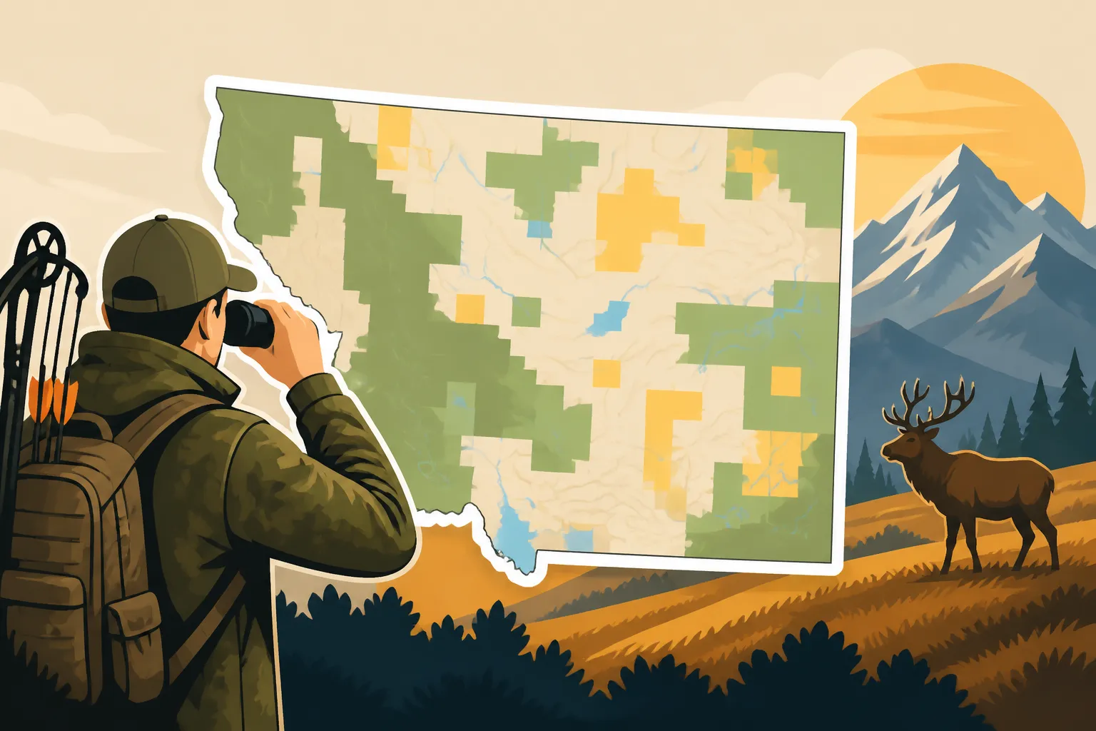
Once you have a district in mind, it's time for initial reconnaissance, which I like to call the "big picture" scan. Open up your preferred digital mapping application, like onX Hunt, and center it on your chosen district. Zoom out to get a sense of the overall land ownership pattern. Do you see large blocks of National Forest or BLM land? Are there numerous scattered state trust land parcels? Or is it primarily private land with a few public islands? This initial scan will tell you a lot about the character of the district and the potential challenges or opportunities for public access. For example, a district dominated by national forest lands in Western Montana will likely offer more straightforward public access, though potentially steeper and more rugged terrain, compared to a district in Eastern Montana with a mix of private ranchland and scattered BLM tracts.
Look for major roads, towns, and obvious geographical features like large rivers or mountain ranges. This early phase is about orientation and identifying major public land masses. Don't worry about minute details yet; you're just getting a feel for the lay of the land and where the big chunks of public ground are located. You're trying to answer the question: "Is there enough public land here to make a hunt viable, and what generally does that access look like?"
Deep Dive with Digital Tools
With your general understanding in place, it’s time to zoom in and get granular, using your digital mapping app to its full potential. This is where onX Hunt truly shines. Activate the land ownership layer, and start scrutinizing every acre of public land within your chosen district.
First, focus on identifying clear access points. Are there public roads that lead directly into federal lands? Are there designated public access easements that cross private property to reach public parcels? onX Hunt is excellent at showing these easements, often marked in a distinct color, which are critical for reaching otherwise landlocked public ground. Don't just look for established roads; scout for two-track trails, forest service roads (some of which may be closed seasonally), and even potential walk-in access points near public land boundaries. Pay close attention to gates and signage in the aerial imagery; sometimes, what looks like a public road might be gated and private further in.
Next, identify the actual boundaries of the public land. Follow these lines carefully. Are they running along a fence line, a creek, or an indistinct ridge? This is crucial for avoiding accidental trespass. Look for those often-frustrating "landlocked" public squares—these are areas where public land is entirely surrounded by private property, making legal access impossible without prior permission or a specific public easement. Sometimes, a seemingly landlocked parcel might have access via a river or stream if it's considered navigable and you stay within the high-water mark, but this can be legally complex and varies by state and water body. Always verify. This detailed digital reconnaissance will help you narrow down your focus to specific areas that are not only public but also genuinely accessible. This kind of diligent e-scouting, as detailed in our guide How to E-Scout Montana Hunting Units, saves countless hours of wasted effort in the field.
Verifying Access and Regulations
Even with the best digital maps, you can't skip this crucial step: verifying access and understanding the specific regulations for the land you plan to hunt. Digital maps are powerful, but they are not always the final word on access, especially for dynamic programs or specific parcels.
For federal lands (National Forests, BLM), it's often a good idea to check with the local Forest Service Ranger District or BLM Field Office. A quick phone call can confirm road closures, fire restrictions, or any temporary access issues you might not see on a map. They can also clarify rules for camping, motorized travel, or specific uses of certain areas. For example, some roads within National Forests might be seasonally closed to vehicles but open to foot or horse traffic.
For state trust lands, always double-check the current Montana FWP regulations regarding the State Land Use License. While hunting big game typically doesn't require an additional fee beyond your base license, understanding any restrictions on specific parcels, especially those leased for agriculture, is vital. You might find signs indicating specific walk-in points or areas to avoid during certain times of the year. Our piece on Montana State Trust Land Hunting offers more specific details.
The Block Management Program is where verification becomes absolutely paramount. These are private lands that offer public access, but each BMA has its own distinct set of rules, including required sign-in procedures, hunter quotas, specific open days, and even parking locations. You must obtain the current year's Block Management Atlas or access the FWP Block Management online portal. Always check the specific rules for the BMA you intend to hunt. Some require you to pick up a permission slip at a local check station, others are simply sign-in boxes at the fence line. Ignoring these rules is a sure way to lose hunting privileges. We have an entire guide dedicated to explaining Montana Block Management Areas Explained and another on How to Use Block Management for DIY Hunts that are indispensable for navigating these opportunities. Never assume; always verify with FWP's official BMA resources.
Navigating Complex Access Scenarios
Montana's hunting opportunities are immense, but so are the complexities of gaining legal access to some of its most productive lands. You'll inevitably encounter situations that require more than just glancing at a map. Understanding these nuances can be the difference between a successful hunt and a frustrating encounter.
Landlocked Public Land and Easements
The term "landlocked public land" is enough to make any hunter groan. It refers to public land that is completely surrounded by private property, with no public road, trail, or navigable waterway leading to it. On a map, it might look like a prime hunting spot – a beautiful, dark timber stand or a hidden valley – but if you can't legally set foot on it without crossing private land, it's effectively off-limits. This is a common issue, especially in the checkerboard ownership patterns often found in former railroad land grants across the West.
However, "landlocked" doesn't always mean "impossible." Sometimes, there are established public easements that provide legal access across private parcels. These easements might be historical agreements, or they might have been purchased by land trusts or government agencies specifically for public access. Your digital mapping apps, particularly onX Hunt, are usually very good at identifying these marked easements, often showing them as distinct colored lines or polygons. Always verify the nature of these easements—some might be for foot traffic only, others might allow vehicles on specific roads. If no such easement exists, your options are limited: you either need to obtain explicit permission from the surrounding private landowner (which can be difficult) or accept that the land is functionally inaccessible. It's crucial to respect these private property boundaries; attempting to cross without permission is trespassing and reflects poorly on all hunters.
State Trust Lands and Their Specific Rules
Montana's State Trust Lands, managed by the DNRC, present another unique set of access considerations. While they are public, their primary purpose is to generate revenue for specific state institutions, meaning their management can be different from federal lands. Most significantly, while hunting big game on State Trust Lands is generally permitted with your Montana Conservation License and hunting tags, you often need to be aware of how you access them. If a State Trust Land parcel is only accessible by crossing private land, you still need permission from that private landowner, just as with federal land.
Additionally, certain activities on State Trust Lands, like fishing, camping, or accessing via non-navigable streams, might require a specific State Land Use License or Recreational Use License. This is separate from your hunting license. While many hunters primarily use these lands for big game access, it's vital to be aware of the nuances. Many State Trust Lands are also actively leased for agriculture or grazing. Hunters are expected to respect these operations, avoid disturbing livestock, close gates, and stay out of active crop fields. Some parcels might have specific signs or rules posted by the lessee that need to be followed. Always check the latest FWP regulations and the DNRC website for the most current rules regarding State Trust Land access to avoid any misunderstandings.
The Importance of FWP and Local Resources
When you're dealing with complex access situations or just want to confirm details, don't underestimate the value of Montana Fish, Wildlife & Parks (FWP) and other local resources. Their websites and, more importantly, their personnel, are invaluable.
The Montana FWP website is a treasure trove of information, hosting the online Hunt Planner which can help you understand specific district rules, season dates, and even provide insights into game populations. Crucially, it's the official source for all Block Management Area information, including maps and rules for the current season. This online portal is regularly updated and should be your first stop for anything related to BMAs. For help navigating the FWP's tools, our guide on Montana Hunt Planner Maps Explained can point you in the right direction.
However, sometimes the best information comes from a conversation. Don't hesitate to call the local FWP regional office for the district you plan to hunt. Game wardens and wildlife biologists often have intimate knowledge of local access points, land status changes, and specific landowner agreements that might not be fully reflected on any map, digital or paper. They can clarify confusing boundary lines, advise on known easements, or even suggest alternative public land access points. Similarly, contacting the local U.S. Forest Service Ranger District or BLM Field Office for federal lands can provide up-to-the-minute information on road closures, current fire restrictions, or changes in access policies. These boots-on-the-ground resources are experts in their areas, and leveraging their knowledge can save you immense amounts of time and potential trouble.
Disclaimer
Please remember that hunting regulations, land ownership, and access rules in Montana can change frequently. While we strive to provide the most accurate and up-to-date information, it is ultimately your responsibility to consult the current Montana Fish, Wildlife & Parks (FWP) regulations, acquire necessary licenses and permits, and verify all land ownership and access before entering any hunting area. Always respect private property and be aware of local conditions and restrictions.