How to Access Landlocked Public Land in Montana
There's nothing quite as frustrating as meticulously e-scouting a promising hunting area in Montana, poring over maps, identifying what looks like prime public land, only to realize it's completely surrounded by private property with no legal access. It feels like hitting a brick wall when all you want to do is explore Big Sky Country and pursue your passion. This guide is all about tackling that exact challenge, breaking down the complexities of landlocked public land in Montana and giving you actionable strategies to find your way in.
Understanding Landlocked Public Land in Montana
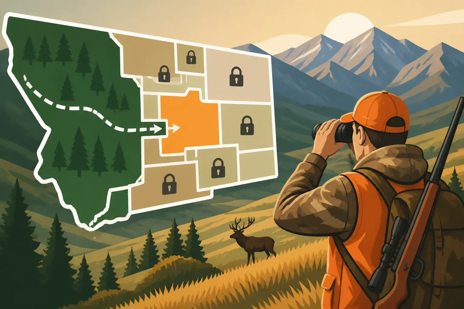
Montana, with its vast stretches of public land, is a hunter's paradise, but it also presents unique challenges, especially when it comes to land access. The term "landlocked public land" refers to parcels of public property—whether it's Bureau of Land Management (BLM), National Forest, or State Trust Land—that are entirely enclosed by private holdings, leaving no direct legal way to reach them without crossing someone else's property. This isn't just a minor inconvenience; it's a significant barrier that can render excellent hunting grounds completely inaccessible.
The Frustration of Checkerboard Ownership
One of the primary reasons for so much landlocked public land in Montana is the historical "checkerboard" land ownership pattern, particularly prevalent in areas granted to railroads in the 19th century. Imagine a massive chessboard laid across the landscape, where every other square belongs to a private entity, and the squares in between are public. While this pattern was intended to encourage development, it has created a maze of fragmented ownership, making it incredibly difficult to navigate without inadvertently trespassing. Many a hunter has stared at their map, scratching their head, trying to figure out how to get to that little green square surrounded by yellow. It's a puzzle that often feels unsolvable, and it can deter even the most determined individual from exploring areas with tremendous potential. The frustration is real when you know game is using those inaccessible parcels, but you're legally blocked.
Identifying Landlocked Public Land on Maps
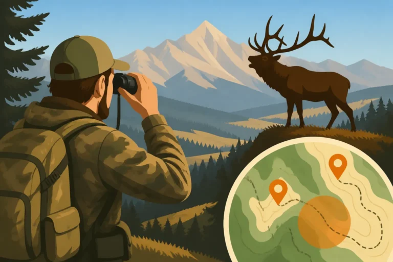
Before you even step foot in the field, knowing how to identify landlocked public land on your maps is crucial. This is where modern mapping applications become an absolute game-changer. Tools like onX Hunt have revolutionized how hunters approach land management and access, displaying property boundaries in vivid detail, color-coding public and private parcels. You'll quickly notice green (National Forest), orange (BLM), or even light blue (State Trust Land) squares or polygons completely encircled by yellow (private land). Don't just look for roads, either. Pay close attention to trails, historical routes, and natural features like rivers or creeks that might seem to offer access but often fall entirely within private boundaries. Sometimes, a tiny finger of public land, perhaps a quarter-mile wide, can offer a legal corridor, but you need to be eagle-eyed to spot it. Learning How to E-Scout Montana Hunting Units is an essential skill for this initial phase of planning.
Legal Avenues for Accessing Landlocked Public Land
While the situation can seem dire, there are indeed legal avenues that sometimes exist to access these otherwise isolated public parcels. It's not always easy, and it often requires diligent research and understanding the nuances of property law, but it's worth exploring before you write off a promising area.
Easements and Rights-of-Way
An easement is a legal right to use another person's land for a specific purpose, such as access. Sometimes, public land agencies like the Forest Service or BLM have existing easements across private property to reach their land. These might be for administrative purposes, timber harvest, or even public recreational access. The challenge is often finding out where these easements are located and if they apply to public hunting. They aren't always clearly marked on maps or signs. You might need to dive into county records, agency land management plans, or even contact the local Forest Service or BLM office directly to inquire about formal easements. Some landowners also grant informal access, but relying on a verbal agreement without something in writing can be risky, as permission can be revoked at any time.
Another type of right-of-way could be a historical public road that has not been formally vacated. These "prescriptive easements" are much harder to prove and often require legal action, but they do exist. Understanding these rights can open up new opportunities for those willing to do their homework. You can learn more about general access strategies in our guide on Montana Public Land Hunting Guide.
Corner Crossing Explained
Perhaps one of the most contentious topics in Western hunting access is "corner crossing." This occurs when a hunter moves from one parcel of public land to another by stepping over the corner where four property boundaries meet, typically two public and two private. The crucial point is that the hunter never physically touches the private land, only the airspace directly above the common corner. For years, this practice existed in a legal gray area, with varying interpretations across states. In Montana, the legal precedent has recently become clearer, with a Wyoming federal court ruling that corner crossing without touching private land is legal.
However, it's vital to understand that while the legal ruling in some jurisdictions supports the legality of corner crossing, landowners may still perceive it as trespassing. This can lead to confrontations, even if you are technically within your rights. It's a complex issue, and while the legal landscape is evolving, discretion and respect for private property owners are always paramount. Always stay informed about current laws and local interpretations, and be prepared for potential challenges. A good resource for staying current on such regulations is often found through organizations like GoHunt, which keeps tabs on hunting legislation and land access issues.
Practical Strategies for Gaining Access
Beyond formal legal rights, there are practical, proactive steps you can take to open up access to those tempting landlocked parcels. These strategies often involve good old-fashioned communication and leveraging existing programs designed to facilitate public access.
Researching Access Points and Historic Use
Before you even think about contacting a landowner, do your homework. Use mapping tools like onX Hunt to identify every single potential access point, no matter how small or unlikely it seems. Look for power lines, old logging roads, or even faint two-track trails that might cross private land to reach public. Sometimes these are informal access points that have been used for decades. Research historical maps or even old aerial photos, if available, to see if there were roads or trails that once served the public land. Local county offices, historical societies, or even long-time residents can sometimes provide invaluable insights into historical access routes that might have been forgotten or informally used for generations. This deep dive into historical use can sometimes unearth prescriptive easements or simply give you a strong argument when approaching a landowner.
Contacting Landowners for Permission
This is often the most direct, and sometimes the most successful, way to access landlocked public land. It might sound intimidating, but a respectful, well-prepared approach can go a long way.
Here's a breakdown:
- Be Prepared: Before you knock on a door or make a call, know exactly which public parcel you want to access, where you plan to enter their property, and what you intend to do (e.g., foot access for hunting, specific dates).
- Timing is Everything: Don't show up during calving season, harvest, or late evening. Choose a time when they are likely to be less busy and more receptive. Early spring or late summer, well before hunting season chaos, can be ideal.
- Dress Respectfully: This might seem minor, but showing up in muddy camo straight from the field might give the wrong impression. Dress neatly and respectfully.
- Be Clear and Concise: Clearly state who you are, what you're asking for, and why. "Hello, Mr./Ms. [Landowner Name], my name is [Your Name], and I'm interested in accessing the BLM land that borders your property to hunt elk. I'm looking for permission to walk across your pasture here [point on map] on these dates."
- Offer Something in Return (if appropriate): While not always necessary, sometimes offering to help with a task (closing a gate, reporting fence damage) or sharing some wild game meat can foster goodwill.
- Be Prepared for "No": Not every landowner will grant access, and you must respect their decision without argument. Thank them for their time and move on. Their property, their rules.
- Get it in Writing: If permission is granted, ask for a simple written note with the dates, specific access route, and any conditions (e.g., "foot traffic only"). This protects both you and the landowner.
- Build Relationships: If you get permission and respect their property, you might find yourself with an invaluable access point for years to come. Remember, you're building a reputation for all hunters.
Learning How to Get Landowner Permission in Montana is a critical skill for any hunter navigating Montana's complex land ownership.
Utilizing Montana's Block Management Program
Montana's Block Management Program (BMP) is a unique and incredibly valuable tool for accessing private land, and sometimes, through that private land, reaching adjacent public parcels. BMPs are voluntary agreements between Montana Fish, Wildlife & Parks (FWP) and private landowners, opening up private lands (and often adjacent public lands) for public hunting access.
These areas vary wildly in size, species available, and access rules. Some are "Type I" areas, which are open access, requiring only sign-in at a kiosk. Others are "Type II," requiring hunters to contact the landowner or manager in advance to schedule access. The key is that these programs can sometimes provide a legal, designated route through private property to public lands that would otherwise be inaccessible.
You can get Block Management Area (BMA) maps and rules from FWP offices, their website, or through mapping apps like onX Hunt which integrates BMA boundaries. Always read the specific rules for each BMA very carefully; some are foot traffic only, some might have vehicle restrictions, and others might be open for specific dates or species only. This program is a testament to the cooperative spirit between landowners and hunters in Montana, and it's an absolute must-research for anyone struggling with landlocked public land. Our guide on Montana Block Management Areas Explained provides even more detail on this fantastic resource.
Here's a quick comparison of common access methods:
| Access Method | Description | Pros | Cons | Best Use Case |
|---|---|---|---|---|
| Easements/ROWs | Formal legal rights granted for passage over private land to public land. | Permanent, legally protected access. | Can be hard to find or verify; may not exist where needed; often administrative. | Long-term, reliable access if found. |
| Corner Crossing | Stepping over the common corner where two public and two private parcels meet, without touching private land. | Can open up vast tracts of land; legally permissible in some interpretations (e.g., recent WY ruling). | Highly contentious with landowners; may lead to confrontations; legal ambiguity in some areas. | Accessing public lands in checkerboard areas where no other access is possible. |
| Landowner Permission | Directly asking a private landowner for permission to cross their property to access landlocked public land. | Builds relationships; can be flexible; often the most direct solution. | Requires effort and diplomacy; permission can be denied or revoked; not always written. | When a direct, one-time or recurring access need arises for specific parcels. |
| Block Management | FWP-managed program where private landowners allow public hunting access on their land, sometimes facilitating access to adjacent public land. | Legally sanctioned; rules are clear; often opens large areas. | Rules vary by BMA; can be busy; limited to specific seasons/species; may require pre-registration. | Accessing a variety of species on private and potentially connected public lands. |
| Historical Access | Researching old roads, trails, or traditional routes that may have a legal claim as a public right-of-way, even if they cross private land. | Can uncover forgotten, but valid, public access. | Extremely difficult to prove legally; time-consuming research; may require legal action. | Very long-term strategy for persistent researchers and advocates. |
Tools and Resources for Navigating Access Challenges
In today's hunting world, technology and information are your best friends when it comes to navigating the complex landscape of land ownership. Using the right tools can save you countless hours of frustration and potentially unlock new hunting opportunities.
Mapping Applications and Digital Scouting
Modern mapping applications are absolutely indispensable for identifying and navigating landlocked public land. I personally rely heavily on platforms like onX Hunt. Its ability to display detailed property boundaries, landowner names, and land ownership types (public vs. private) in various color codes makes the "checkerboard" puzzle much clearer. You can quickly see where public land is surrounded by private, where a thin sliver of public land might provide a corridor, or if a Block Management Area might offer a route through.
Beyond just identifying access issues, these apps allow you to:
- Identify Landowner Contact Info: While not always available, some premium versions of mapping apps can provide landowner names and mailing addresses, giving you a starting point for requesting permission.
- Overlay Layers: You can often overlay satellite imagery, topographic maps, and even wildfire history or game migration routes to get a full picture of the area.
- Track Your Location: In the field, knowing exactly where you are relative to property boundaries is crucial. This prevents accidental trespassing, which is vital for maintaining a good relationship with landowners and staying legal.
- Mark Waypoints: You can mark potential access points, gates, or areas of interest for future reference.
- Download Offline Maps: Essential in areas with no cell service, which is common in much of Montana's prime hunting country.
Another excellent resource is GoHunt's Insider platform. While it doesn't offer the same real-time mapping functionality as onX, it provides incredibly detailed data and analysis on hunt units, draw odds, and species information, which can help you prioritize which landlocked areas might even be worth the effort of finding access for. When you're trying to figure out How to E-Scout Montana Elk Before the Season, these digital tools are non-negotiable.
State and Federal Agencies as Resources
Don't underestimate the wealth of information available from government agencies. Montana Fish, Wildlife & Parks (FWP) is your first stop for anything related to hunting regulations, season dates, and access programs like Block Management. Their regional offices often have staff who are intimately familiar with local land ownership and access issues. They can provide maps, answer questions about specific hunting districts, and guide you to resources.
Similarly, the local offices of the U.S. Forest Service (USFS) and Bureau of Land Management (BLM) manage vast tracts of public land. They are excellent resources for understanding easements, road access, and special use permits that might affect access to their lands. They can often provide detailed maps, administrative boundary information, and insights into specific regulations for wilderness areas or national forests. For those planning a bigger adventure, contacting the USFS office covering areas like the Bob Marshall Wilderness Hunting Guide could be critical for understanding specific entry points.
Ethical Considerations and Best Practices
Accessing landlocked public land often puts you in close proximity to private landowners. How you conduct yourself will not only reflect on you personally but on the entire hunting community. Being a good steward of the land and a respectful neighbor is paramount.
Respecting Private Property and Wildlife
Even when you have legal access, whether through an easement, permission, or a BMA, remember that you are often still on or adjacent to private property. This means adhering to a strict code of conduct:
- Stay on Designated Routes: If given a specific route to follow across private land, stick to it. Do not wander off into pastures, fields, or residential areas.
- Leave Gates as You Find Them: If a gate is closed, close it behind you. If it's open, leave it open. This is crucial for livestock management.
- Pack It In, Pack It Out: Leave no trace of your presence. This includes spent cartridges, food wrappers, flagging tape, and anything else you brought with you. In fact, strive to leave the area better than you found it.
- No Poaching or Trespassing: This should go without saying, but never assume permission for one thing (e.g., walking through) extends to another (e.g., hunting private land). Always be crystal clear about the scope of your access.
- Manage Your Dogs: If hunting with dogs, ensure they are under strict control and do not harass livestock or wander onto undesignated private property.
- Be Mindful of Noise: If accessing near homes, keep noise to a minimum, especially early in the morning or late in the evening.
Respect for wildlife goes hand in hand with respecting property. Ethical hunting practices, responsible game retrieval, and minimizing disturbance to other animals are all part of being a good hunter. Learn about specific game habits in guides like Montana Elk Behavior During the Rut to enhance your ethical approach.
Leaving No Trace and Being a Good Neighbor
The concept of "Leaving No Trace" extends beyond just packing out your trash. It means minimizing your impact on the land, whether public or private. This includes:
- Staying on Existing Trails/Roads: Avoid creating new trails, especially in sensitive areas or on private land.
- Minimizing Impact to Vegetation: Be careful not to damage fences, crops, or other private property infrastructure.
- Being Visible and Accountable: If a landowner asks you a question, stop, be polite, and answer truthfully. Introduce yourself. A friendly face and a polite interaction can make all the difference.
- Adhering to Fire Restrictions: Always be aware of local fire danger and restrictions, especially during dry seasons. A careless campfire can devastate vast areas and instantly erode goodwill.
- Sharing Information (When Appropriate): If you discover issues like downed fences or other problems on a landowner's property while passing through, politely inform them. This demonstrates care and responsibility.
By consistently demonstrating respect and responsibility, hunters contribute to a positive perception of our community. This helps ensure that programs like Block Management continue to thrive and encourages more landowners to open their property for access, which is crucial for public land access in a state like Montana. Understanding How to Beat the Crowds on Montana Public Land often comes down to finding and respectfully using these harder-to-reach parcels.
Remember, every time you successfully and respectfully access landlocked public land in Montana, you're not just opening up an opportunity for yourself, but potentially for future generations of hunters.
Disclaimer
Please note that hunting regulations, land access laws, and private property boundaries are subject to change. Always consult the most current Montana Fish, Wildlife & Parks regulations and official land management maps before planning any hunt. This guide is for informational purposes only and does not constitute legal advice. It is your responsibility to know and follow all applicable laws and regulations.